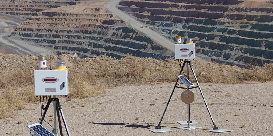
Miami sits just six feet above sea level on average, and that number dictates everything about how we excavate here. The city’s population passed 450,000 in 2023, fueling a construction boom that pushes foundations deeper into the Biscayne Aquifer. When you cut into oolitic limestone with the water table less than two meters down, wall movements and dewatering effects become immediate concerns—not theoretical ones. Our instrumentation program tracks inclinometers, piezometers, and settlement points continuously, giving the design team data to confirm that the excavation is behaving as the shoring design predicted. In downtown Brickell, where 50-story towers rise from tight footprints, we often deploy automated total stations alongside traditional crack monitors on adjacent historic structures, because a half-inch movement in the wrong direction can trigger a Stop Work order from Miami-Dade Building Officials. The same crew handling the monitoring runs the CPT testing to refine the soil profile, or the deep excavation design when the shoring needs re-evaluation mid-project.
In Miami, the difference between a successful deep excavation and a costly repair is often 0.25 inches of lateral movement that someone caught early.
Site-specific factors
The classic Miami mistake is assuming the limestone will behave like rock. It won't. The Miami Formation is porous, riddled with solution features, and loses strength when exposed to air and water cycling during a long excavation. Contractors who skip baseline condition surveys on adjacent buildings before starting the dig can end up paying for pre-existing cracks that nobody documented. Even worse, failing to track the cone of depression from dewatering can cause settlement hundreds of feet away, pulling the ground out from under shallow foundations on older buildings in Little Havana or along Calle Ocho. We've seen cases where a single malfunctioning piezometer went unnoticed for a weekend, and by Monday the retaining wall had deflected nearly an inch, cracking a neighboring parking garage slab. The IBC and ASCE 7 don't just recommend monitoring for Category III and IV structures—the Miami-Dade amendment to the Florida Building Code essentially requires it for any excavation exceeding 12 feet. The instrumentation is cheap compared to the delay and litigation that follow a failure.
Common questions
How much does geotechnical excavation monitoring typically cost for a Miami project?
Monitoring programs in Miami generally range from US$910 to US$2,400 per month, depending on the number of instruments, the frequency of manual readings, and whether you need automated data acquisition with cloud access. A basic setup with a few settlement points and a single inclinometer runs on the lower end; a full suite with multiple piezometers, automated total stations, and vibration monitors on a deep lot in Brickell will be at the higher end. We provide a fixed-price proposal based on the excavation depth, adjacent structures, and the duration your shoring design requires.
At what excavation depth does Miami-Dade County require geotechnical monitoring?
The Miami-Dade County amendments to the Florida Building Code require monitoring for excavations deeper than 12 feet when they are adjacent to public rights-of-way or existing structures. Even for shallower cuts, the engineer of record often specifies instrumentation if the site is classified as a Category III or IV facility per ASCE 7, or if the geotechnical report identifies solution-prone limestone that could cause sudden loss of ground. Practically speaking, almost any project with a tieback wall or a basement deeper than one level in Miami will have a monitoring plan approved by the building official.
How do you handle monitoring during Miami's hurricane season?
All surface instruments and data loggers are rated for tropical storm conditions and secured in NEMA 4X enclosures. We establish pre-storm baseline readings 24 hours before a projected landfall, then perform a rapid post-storm survey to detect any movement caused by pressure changes or flooding. Automated systems continue logging during the event, and we can configure alerts to notify the project team if piezometric levels spike or if a wall section shows unexpected displacement during heavy rainfall.
Can you monitor existing cracks on neighboring buildings before we start the excavation?
Yes, and this is one of the most important steps in a Miami excavation project. We install tell-tale crack gauges and take high-resolution photographs of every visible defect on structures within the zone of influence. This pre-construction condition survey is dated and signed, creating a legal baseline. If a crack opens later, the gauge shows exactly when and how much it moved, which helps determine whether the excavation caused it or if it was a pre-existing condition that simply became visible due to seasonal humidity changes in the concrete.