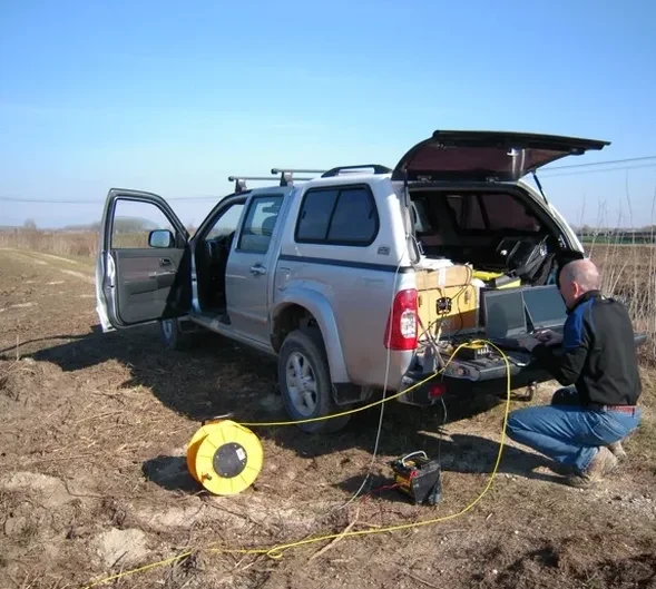
We see it often. A contractor gets a site in West Miami-Dade and assumes the limestone is solid. They skip the geophysical survey. Then the drill rig hits a cavity and the project stalls for weeks. Miami's geology doesn't forgive assumptions. The shallow Ocala Limestone and Fort Thompson Formation are riddled with solution features. Rainwater dissolves the carbonate rock, creating voids and pinnacles you can't see from the surface. Seismic tomography, both refraction and reflection, maps these anomalies before you mobilize heavy equipment. We generate a velocity model of the subsurface that shows the contact between competent rock and raveled zones. For foundation design near the coast, where saltwater intrusion accelerates dissolution, this data is not optional. It's the difference between a straightforward pour and an emergency redesign. We also pair tomography with MASW surveys when shear-wave velocity profiles are required for seismic site class determination per ASCE 7 and the Florida Building Code.
In Miami karst, a single missed cavity under a pile cap can cost more than the entire geophysical survey.
How we work
South Florida's subtropical climate creates specific challenges for seismic acquisition. The high water table, often just three to five feet below surface in eastern Miami-Dade, saturates the overburden. That saturation attenuates high-frequency signals, so we adjust our source energy and geophone spacing accordingly. During summer afternoons, when thunderstorms roll in every day like clockwork, ambient noise from rain and traffic on I-95 degrades signal-to-noise ratio. We schedule acquisition for early morning windows to capture clean first arrivals. Our crew uses a 24-channel seismograph with 14 Hz vertical geophones and a weight-drop source for refraction work. For reflection surveys targeting deeper stratigraphy, we deploy a 48-channel spread and a higher-energy impact source. The result is a tomographic cross-section that resolves velocity contrasts down to 100 feet or more, depending on site conditions. We process the data with iterative ray-tracing algorithms, not simple time-intercept methods, because Miami's laterally variable karst demands full waveform inversion to avoid smoothing artifacts.
Site-specific factors
Miami-Dade sits on the Miami Limestone, a soft, oolitic facies of the Biscayne Aquifer. The rock is young, porous, and riddled with dissolution conduits. A 2018 Florida Geological Survey study mapped over 3,000 verified sinkholes across the county. Most are small, but the risk is real. If you place a mat foundation or driven piles without a velocity cross-section, you risk differential settlement across a hidden raveled zone. The IBC classifies much of Southeast Florida as a karst-prone terrain requiring special inspection. We've imaged cavities as shallow as 15 feet under proposed building pads in Hialeah and Homestead. The reflection tomography picks up the acoustic impedance contrast where air-filled voids meet limestone. Refraction data shows a velocity pull-down where the roof of a cavity has collapsed into a raveled chimney. Without this data, a standard SPT boring can miss a void by three feet and give you a false sense of security.
Common questions
Can seismic tomography detect sinkholes before they reach the surface?
Yes, that's one of its primary applications in Miami. The velocity model shows low-velocity zones corresponding to raveled sediments above a dissolving limestone cavity. A sharp velocity contrast between 4,000 ft/s competent rock and 1,500 ft/s raveled material is a clear indicator. We've identified incipient sinkholes under parking lots and roadways that showed no visible surface expression.
How much does a seismic tomography survey cost in Miami?
For a typical commercial site investigation, our surveys range from US$2,530 to US$5,670 depending on line length, depth of investigation, and whether we run refraction only or combined refraction-reflection. Urban sites with high ambient noise may require additional processing time and energy, which affects the final quote.
What's the difference between seismic refraction and MASW?
Refraction tomography gives you a P-wave velocity model, which maps material stiffness and detects voids. MASW gives you shear-wave velocity, which is what structural engineers need for seismic site classification per ASCE 7. We often run both on the same spread. The P-wave data locates anomalies, and the S-wave data provides the Vs30 for the foundation design.
Do you need permits to conduct seismic surveys in Miami-Dade?
We handle all right-of-way permits if the survey line extends onto public property. For private lots, no permit is needed for the geophysical work itself, though we coordinate with the general contractor for site access and underground utility clearance via Sunshine 811 before any source impacts.